Are you ready to experience the Missouri countryside like never before? We’ve created the perfect itineraries for spending a few days along the Katy Trail by bike, watercraft, or on foot. Don’t miss out on some of the stops along the way—from local faire to live music, there is a lot to take in. Better get packing!
If you’re looking for the best way to enjoy the Katy Trail by bike, we’ve created an itinerary for the perfect route, complete with our favorite stops along the way.
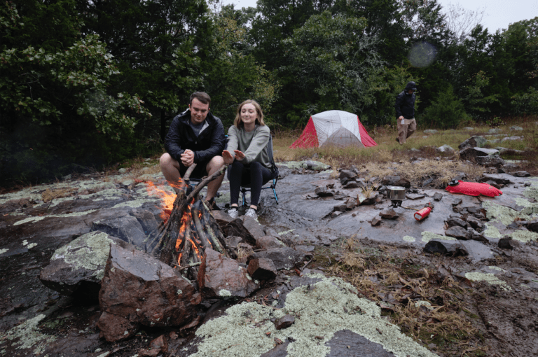
Set out on your journey from Machens, where the bike trail begins. Note that this is considered mile marker 26.9. This is because the markers are holdovers from the railway, which began its route near St. Louis. Take advantage of the restrooms here, then saddle up and prepare for the day ahead. Your first efforts will take you 3 miles to the bike repair station at Black Walnut Trail Head. This is a good place to iron out any last-minute issues you may have just become aware of. When you’re feeling good, continue on for 9 miles until arriving on the riverfront. From here, there are two good options for lunch. Either stop directly at Big A’s for a burger and a round of pool, or continue on for .5 miles to Trailhead Brewing, where you can enjoy a well-deserved craft beer with your meal. Having eaten, the next step is 7.5 more miles to Thies Greenhouse. A family operation for 6 generations, the fresh produce at this market is just the thing to take back to your campsite for dinner. Pack up your haul and get back on the trail. 18 more miles will take you all the way to Klondike Park. Choose one of the 43 available campsites, pitch your tent, and start up the camp stove—it’s time to get down to roasting some of those veggies and relaxing under the impressive display of stars. There is a bathhouse on site for a hot shower. If you’re in the mood to splurge, there are also six cabins for rent within the campground. Total for the day: 37.5 miles, ending at marker 64.1
Feeling rested? It’s time to get back out there. Strike out westward, heading for the Augusta Trailhead. Grab some morning joe from Kate’s Coffee, and make a stop at Katy Bike Rental for any repairs that need to be seen to. 8 miles down the trail, you’ll find Dutzow Deli & Restaurant, ideal for wolfing down a stack of pancakes or a hearty sandwich. Alternately, 12.5 miles from Augusta is Lake Creek Winery, where you can enjoy an upscale bite and a glass of one of their house wines. If you’re after a taste of the local culture, 17.5 miles will get you to Peers Store. Listen to live music on the porch, browse the selection of art, and munch on a snack for a little rejuvenation. In Marthasville, near the Lake Creek Winery, you’ll find Thierbach Orchards. Depending on the season, pluck a few crisp apples off the trees or grab a carton of berries to keep you going. After all that excitement, head back to Community Club Park in Marthasville to spend the night. If the pavilion is full, a field across the street offers additional space. Another bathhouse with showers means climbing into your sleeping bag feeling clean and smelling good. Total for the day: 14 miles, ending at marker 78
Make sure to get a good breakfast on this morning, because the first leg is 22.5 miles to McKittrick. Stop at Loutre Market for a last grocery resupply, and then cross the river via the bridge just west of the Highway 19 underpass into Hermann. If your craft beer itch hasn’t been fully scratched, check out Tin Mill Brewing Company. If wine is more your thing, there’s Hermannhof Winery. For a quicker stop, take a break at the McKittrick Trailhead for restrooms and a repair station. Ride 9 more miles to Steamboat Junction Campground. There are five tent sites available in the lower campground, and a few more are scattered along the upper ridge. Snacks and drinks are sold by the campground staff on weekends. If Steamboat is full, try Blufton Barn. This campground features a fully furnished kitchen, laundry facilities, and a bathhouse with hot showers. This is a great spot for a bonfire with friends to celebrate the end of your trip. Total for the day: 33 miles, ending at marker 110.7 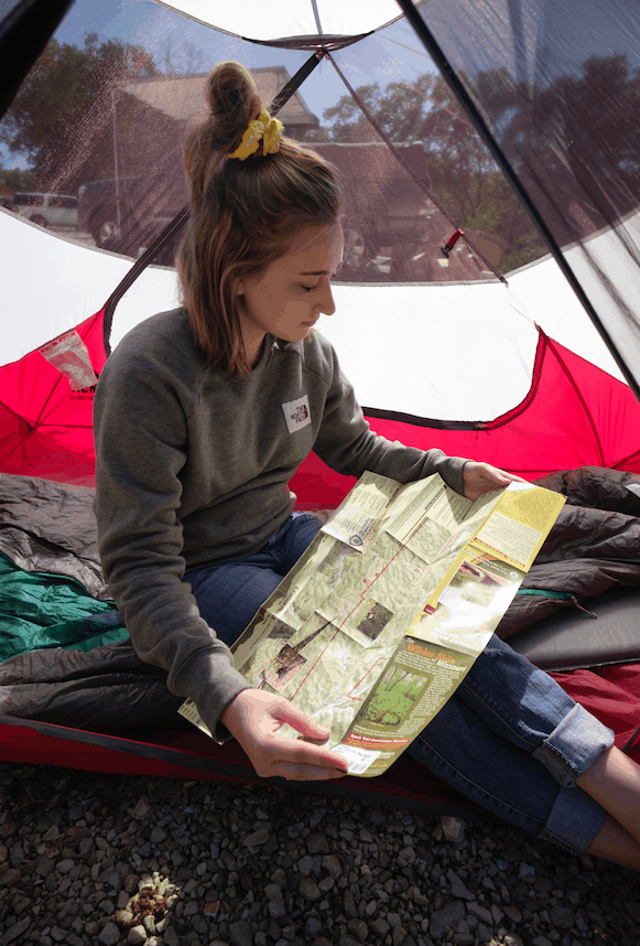
If hoofing it is more your thing, check out the route from Franklin to Hartsburg. Along the way, you’ll find plenty of restaurants, campsites, and oddities that will have you excited to round every corner.
Start this time in Franklin, where a stop at Casey's General Store for some coffee and homemade donuts hot from the oven will provide just the fuel you need for the start of your adventure. Stop for a quick look at the Santa Fe Trail Monument before setting out on trail. Having completed the first 5.5 miles, stop for a picnic lunch at the Davisdale Conservation Area, which is a campground, but lacks running water and restrooms. So plan ahead and prepare! 4 miles farther on, you’ll come to downtown Rocheport. In the evening, head to Abigail’s for dinner, followed by a drink at the Rocheport General Store & Cafe to take in some live music. If you’re interested in a short after-dinner stroll, take a walk to see the old MKT Logo painted on the bluffs near the edge of the river. Spend the night at Diana Bend Conservation Area, a primitive campsite on the river delta. There are no facilities or water spigots here, so be sure to pack your filtration system to treat the river water and read up on waste management and other regulations. On the way out of town, you’ll pass through the Rocheport Tunnel, a historic railroad tunnel that was featured in the movie for Stephen King’s Sometimes They Come Back. Total for the day: 9.5 miles, ending at marker 180
Break camp and head for the Meriwether Cafe and Bike Shop, where a stack of pancakes has your name on it. All of their ingredients are locally sourced, and these from-scratch recipes will make the morning so much brighter. When you’re ready to hit the trail, make a pit stop at the Rocheport Trailhead to fill your water bottles and take advantage of the facilities. Then lace up those boots and get walking. You can also drop by Les Bourgeois Winery & Bistro for brunch and a wine tasting. You’ll find them one mile west of Rocheport. As you pass by, make sure to step off the trail and say hello to Edward ‘Ted’ Jones, who was instrumental in establishing the Katy Trail, and whose memorial marker lies alongside it near mile marker 178. For lunch, there’s The Station House at Katfish Katy's. Grab some hushpuppies and fish tacos and take in the views of the river. When you’re back on the path and making tracks, keep your eyes peeled near mile marker 174.4 for some petroglyphs left by Native Americans. Look for them about 50 feet above the cave entrance. Just off the trail near marker 170, down Burr Oak Road toward the river, you’ll find the oldest burr oak in the state of Missouri. Its massive trunk takes seven people holding hands to encircle it! The McBaine Trailhead offers restrooms and potable water half a mile further on. Pitch your tent at Cooper's Landing, where the amenities are plentiful. Here you’ll find laundry facilities, showers, and cottonwood shade on the riverbank. Food trucks will sometimes set up shop at the landing, so keep an eye out! Tent sites are first-come, first-served. Total for the day: 15 miles, ending at marker 163.5
Eat breakfast at your campsite prior to getting back on trail, stocking up on supplies from the Cooper’s Landing Store before heading out. Crush the first 6.5 miles, and then take a break at the Riverview Traders General Store, where a cold drink will put some spring back in your step. Stop for a picnic lunch here if you’re feeling peckish. Knock out the last 3.5 miles between you and Hartsburg, where dinner awaits. If dining out sounds good to you, try the Hitching Post Bar & Grill for an authentic river-town experience. There are two camping options for the evening. Katyrest Caboose offers a few dispersed tent sites alongside the caboose itself, which is available for rent. There are shower facilities only in the train car. The other option is Volunteer Park, a collection of primitive campsites near the Hartsburg Trailhead. There are restroom facilities near the trailhead, where water from the sink can be treated for cooking and drinking. Time to sit back, relax, and celebrate. You’ve made it! Total for the day: 10 miles, ending at marker 153.6 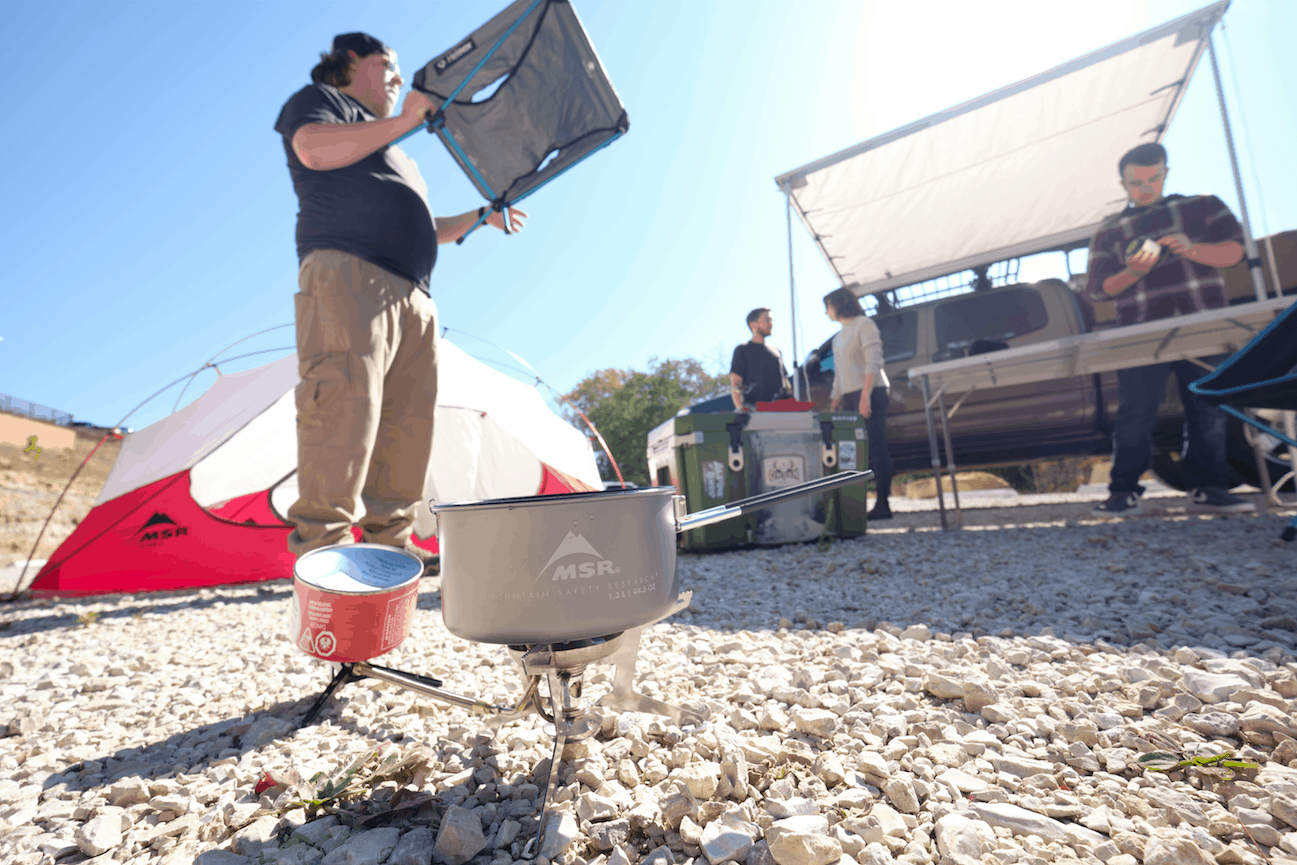
Paddling on the mighty Missouri River is an adventure accessible to most people with the proper planning and gear. The river itself is very unlike most other Ozark waterways. If you capsize on the Current or upper Meramec, you can usually just wade to shore. That is not an option on the Missouri River, so please wear your life jacket at all times. Kayaks should be longer than 12 feet, and have flotation in the front and rear. Always check the weather reports and river levels before you get on the water. If you have any questions about the necessary skills or equipment, please contact a local paddling club, or one of the kayak instructors from Alpine Shop.
Put in at the boat ramp at Riverfront Park in Hermann, MO. There are actually two ramps, but we recommend using one on the right (as you face the river). Otherwise, you’ll need to paddle upstream to avoid the current pushing you into the second ramp. The city of Hermann is especially picturesque from the river. Enjoy it while it lasts, because after only a few miles of paddling, you won’t see any evidence of civilization. This first leg of your journey should be very relaxing. The sound of trains and traffic will be replaced by the sounds of birds, while houses and streets will become forest and gently rippling water. You may begin to get a sense of what the river looked like to Lewis and Clark. After about fourteen miles, you should be able to see the town of New Haven, MO on the right. After landing at the boat ramp in New Haven, walk up the levee. You’ll find five campsites with picnic tables and fire rings intended specifically for people packrafting the Missouri. Set up camp and start exploring the historic village. Grab some pub grub at Duenke’s restaurant, and then walk over to Pinckney Bend Distillery to sample some of their fantastic whiskeys and gins. Visit the Astral Glass Studio and Gallery to snag some goodies for the folks back home (or for yourself!) and then walk over to Paddle Stop New Haven. They build beautiful wood kayaks, canoes, and SUPs, and they LOVE to talk about the river. In the evening, as you settle into your tent and listen to the river flowing past, try to picture how the town looked when its shores were lined with steamboats and its streets were full of carriages. Looking only at the river in the quiet Missouri night, it becomes easy to imagine. New Haven was the home of the famous mountain man John Colter, of Lewis and Clark Expedition fame. Along the riverfront, you’ll see a few displays that detail some of his adventures. Total for the day: 16 miles
Your second day on the river should be even more relaxing than the first. Don’t be surprised if you go the whole day without seeing other people. If the river is low enough, stop for a picnic lunch on one of the sandbars. When you arrive in Washington, you’ll see John G’s Bier Deck right across the parking lot. It’s a great place to sit on the deck and have a drink. While there are a bunch of places to eat right nearby, try walking a couple blocks upstream to get some awesome barbeque from Sugarfire. As for as accomodation for the night, there are a number of B&Bs near the riverfront, or you can camp in the park by the boat ramp. Total for the day: 13 miles
This will be the longest day of the trip, so try to get an early start. As you leave Washington, paddle upstream 100 or so feet before merging into the current. A few miles outside the city, you’ll see the smokestacks of the Labadie Power Plant in the distance. Across the river from the power plant is the boat ramp for Klondike County Park, and it’s a good place to stop for lunch. As you leave Klondike, you’ll see the 300-foot bluffs of St. Albans a couple miles ahead. Along the base of the bluff is the famous Tavern Cave. Native Americans occupied the cave for thousands of years, followed by French and Spanish explorers. Lewis and Clark stopped at the cave in 1804 as they were traveling up the Missouri, and they stopped there again in 1806 on their way back to St. Louis. The bluff continues for a couple miles along the river to Howell Island. Take out at Weldon Spring Conservation Area, which is on the left across from the island. Total for the day: 19 miles Most paddlers know that the shuttle is the most logistically difficult part of any kayak trip. Fortunately, there are a couple folks who can help take you back to your vehicle after your adventure. Before setting out, contact Tony at the Bike Stop Cafe in St. Charles, or Shane at Paddle Stop New Haven to see if they can help with your return trip. There you have it—some highlights of the Katy Trail. Don’t be surprised, however, if you discover some hidden gems along the way. Missouri is full of them, so get out there! Before you leave, make sure to gear up at Alpine Shop, where we’re ready to help you get a good night’s sleep out on the trail. It’ll make all the difference. Click here to see interactive map
If you've ever hit the slopes on your board and wished - just once - that you didn't have to sit down or bend down to strap your boots into your bindings... well, Burton may j
Read More
We don't know how long this crisis will last, but while we're able to, we believe we need to "nourish our spirits" by taking a walk through our local parks, by hiking our beloved
Read More
In light of increasing developments resulting from COVID-19 along with reviewing the most current health information from St. Louis City and County health departments, and aft
Read More
 Checklists
 Personal Shopping
 Boot Fitting