 Checklists
 Personal Shopping
 Boot Fitting

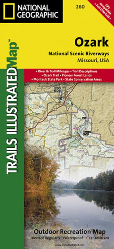


Trails Illustrated Nat Geo
Ozark National Scenic Riverways Map
item # 260
regular price: $14.95 sale price: $11.96 (20.0% OFF)
- Published with the assistance of Eastern National, a nonprofit association that supports Ozark National Scenic Riverway's interpretive program, this map covers the Ozark Trail, Pioneer Forest Lands, Montauk State Park, Current and Jacks Fork Rivers, and State Conversation Areas Features:
- Towns include: Mountain View; Van Buren; Winona
- Includes comprehensive river and trail mileages, boating access points, campsite and recreational points-of-interest, and trail descriptions
- Insets provide information on local hunting, fishing, ATV, horseback riding, and caving regulations
- Approximately: 4 1/4 in x 9 1/4 in folded; 25 1/2 in x 37 3/4 in fully opened
- Scale: 1:63,360
- Map revised 2007