 Checklists
 Personal Shopping
 Boot Fitting

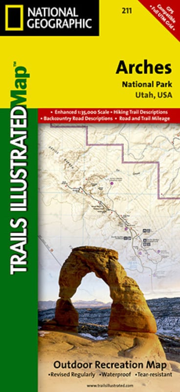


Trails Illustrated Nat Geo
Arches National Park Map
item # 211
$14.95
- This map includes Arches National Park, The Highlands, Little Valley, Devils Garden, Lost Spring Canyon Wilderness area, Negro Bill Wilderness area, Scott M. Matheson Wetlands Preserve, Cache Valley, Delicate Arch, Broken Arch, Sand Dune Arch, Pine Tree Arch, Private Arch, Dark Angel, Double Arch, and more
- The map also includes the Colorado River, the Windows Section, Petrified Dunes, and fascinating information about the park's geology, archaeology, history, and culture
- The map has been updated to reflect road closings, new trails, and campground relocation, and includes detailed trail information, points of interest, trailheads, picnic areas, facilities, and more
- Includes UTM grids for use with your GPS
- Approximately 4 1/4 in x 9 1/4 in folded; 25 1/2 in x 37 3/4 in fully opened
- Scale = 1:35,000
- Map revised - 2005